
The British Settlement at Bigbury Wood, Harbledown
A visit to Bigbury Fort, Harbledown.


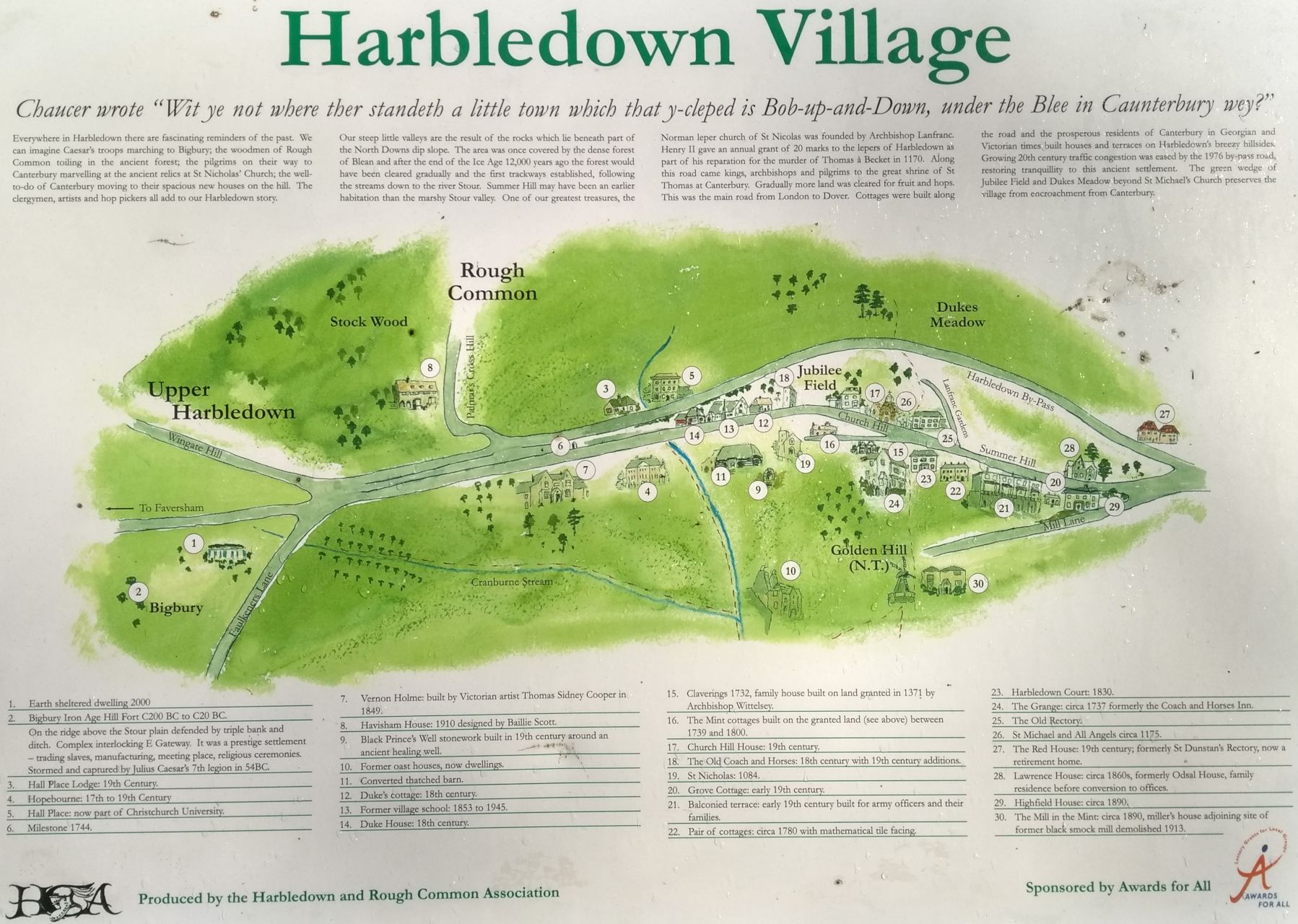
After walking around the nearby village of Harbledown, preparing a trail for the children for Christmas afternoon last year, I spotted the village map. Various points of interest were listed, including dates showing the village's history. I'll delve into the village properly another time, however, the map did cause me to search for books on the village, which in turn led me to an eBay auction for an article on "The British Settlement at Bigbury Wood, Harbledown". In this post I look into that settlement.
The eBay auction listed the item as (a direct copy and paste):
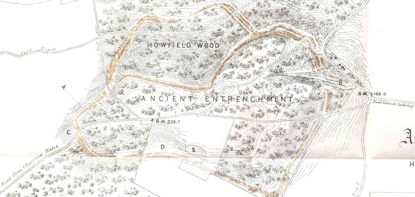
This dis-bound extracted article is from the journal 'Archaeologia Cantiana Vol. 9 for 1874
A short paper discussing the position of an early settlement at Harbledown the embankments & ditches of which were leveled in the 1860's it has a large folded map of the area of interest showing where the embankments & ditches were 3pp with a pull out map
I'll be honest, beyond an article and a map I had no idea what I was buying but for just over £5 I didn't think I could go far wrong. I won the auction and waited for this oddity to arrive. For those of you wanting to follow along, part of the journal's contents can be found here, with a PDF of what I received here.
The village map I mentioned in the introduction also described the settlement as a "fort" (item #2) and made reference to the Roman operation designed to storm it. Caesar's 7th Legion are said to have captured the fort in 54BC. The settlement was one of "high antiquity" and would have been important enough at the time, yet it's disappeared somewhat from common knowledge.
Looking at the extract from Archaeologia Cantiana we read the settlement was "the supposed scene of some of Caesar's most vigorous military operations, immediately after his landing in Britain" [1, p.13] although the author doesn't seem 100% convinced. Sadly that's all the paper says on the matter.
Detailed excavations were made in 1933 [2], published in Archaeologia Cantiana in 1936. The 1936 document goes into some depth showing photographs of the excavations and listing the findings. You'll note the 1936 article uses the now incorrect spelling of Bigberry, a spelling also found on maps dated 1872 and in 1799 as seen in the British Library. Interestingly a present day stables near to the fort also uses the Bigberry spelling.
Accessing the site
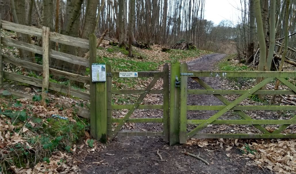
Being interested in historical features in my surrounding area I planned a trip to see what remained. On 16th March 2019 I was joined by my friend Tim as we surveyed the fort / encampment / settlement. Sited on the North Downs Way, I was pleased to find we wouldn't have any issues accessing the land.
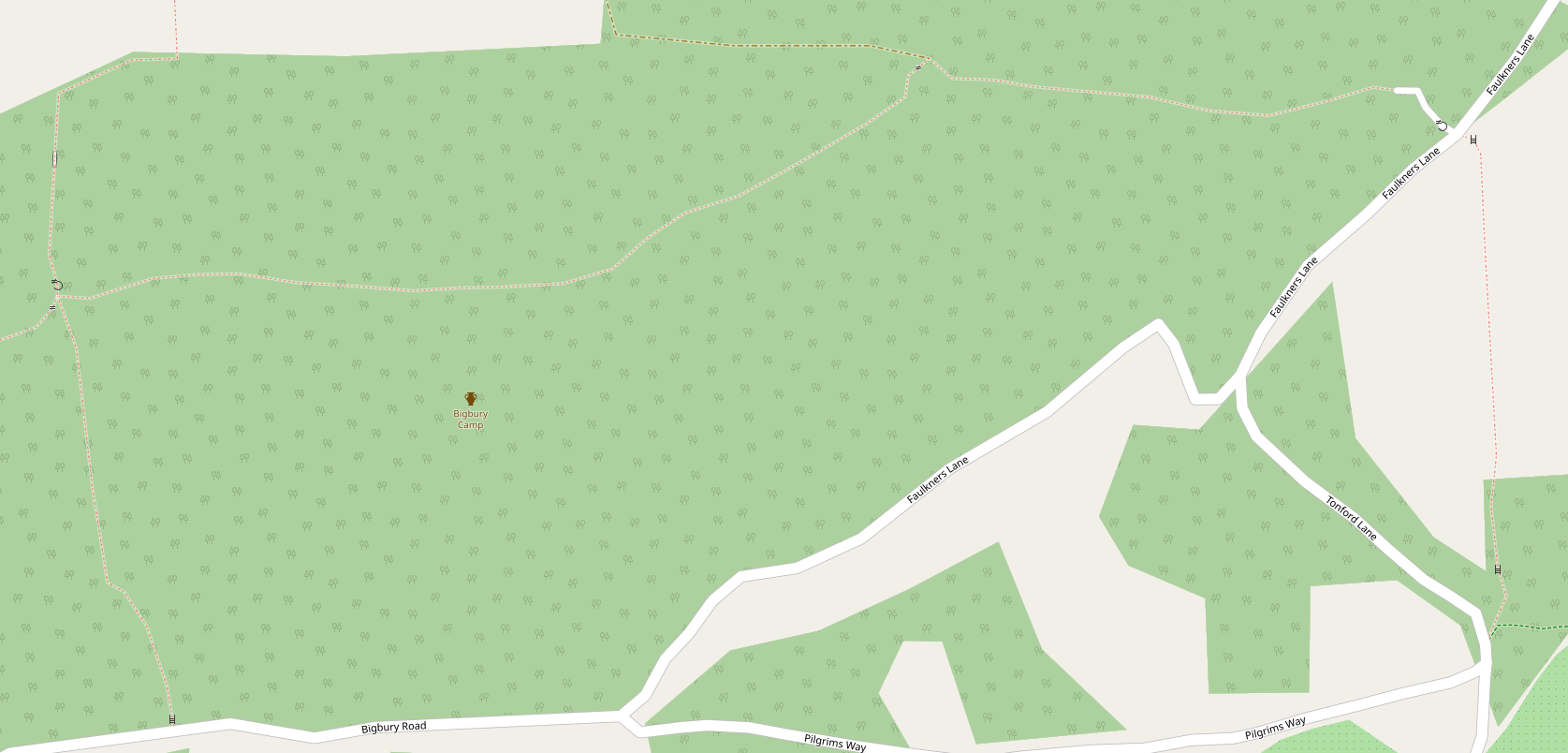
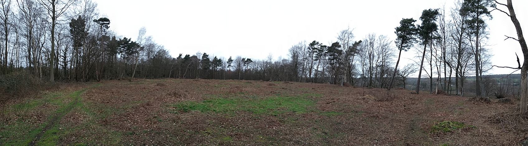
OpenStreetMap and What3Words place the settlement at ///start.descended.cakewalk (or 51.27869, 1.03314 if you want GPS), within a nature reserve accessed via a gate at ///wells.inclined.opened just off Faulkners Lane. After walking in to the nature reserve you immediately realise the enormity of the place - it's a massive open space and I'm amazed that despite visiting Harbledown for over 30 years I didn't know this green land was here. Not only is the area a large open space, there's also quite an elevation towards Bigbury Road.
Tim and I both remarked how the area was incredibly peaceful, even with the A2050 nearby. To reach the fort you have to walk most of the way through the nature reserve (if you access via ///wells.inclined.opened) where you'll discover an information board from Kent Wildlife Trust. The board shows an artist's impression of the encampment along with some informative text which you can read by viewing the image full size, here.

Aerial views
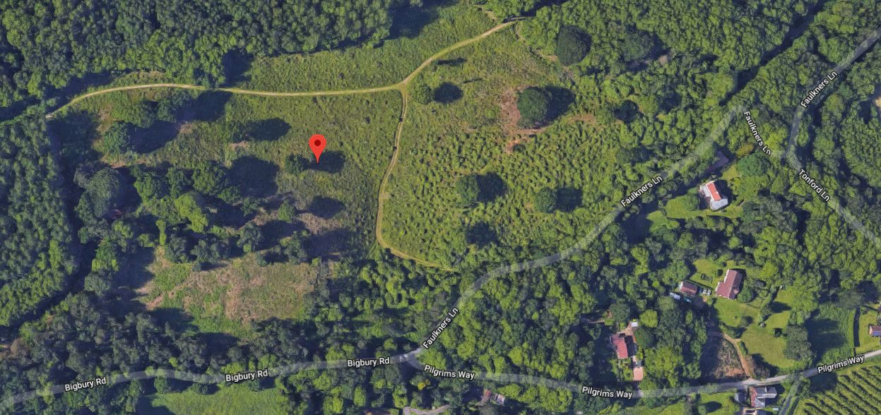
Below are two aerial views of the fort and its surrounding nature reserve. The colour image is copyright Google while the black and white LiDAR image is from LidarFinder.com. There's nothing of the fort to see from the LiDAR imagery as the encampment was stormed over 2,000 years ago. The 1933 survey also found no post holes. Click the relevant link for larger versions of the LiDAR and Google aerial view.

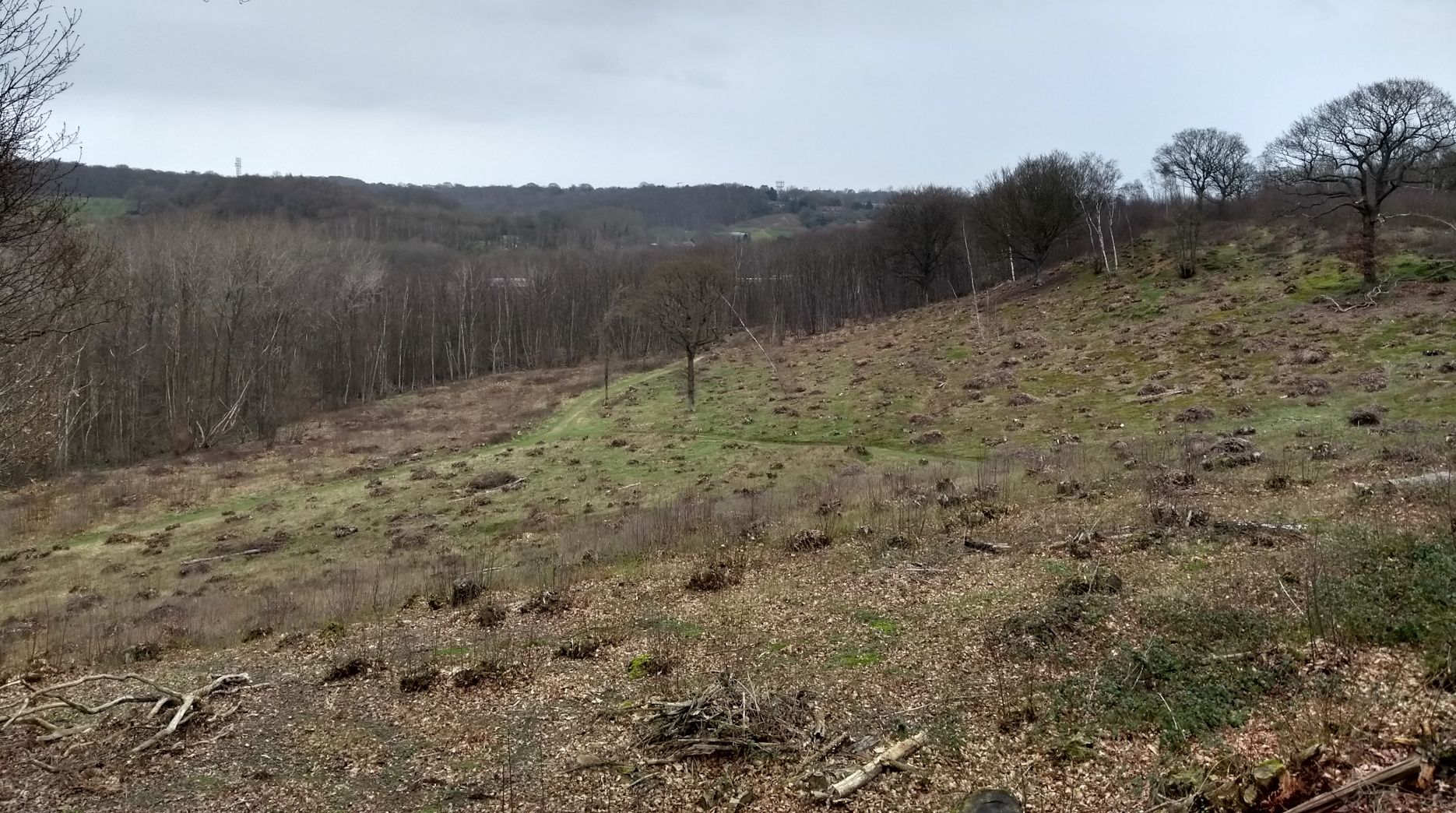
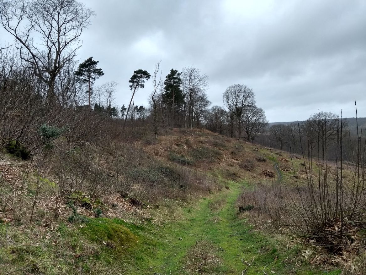
Site visit photos
As expected, there wasn't a lot to see although I've already covered the atmosphere of the place. Here's some photos taken during the visit.
Further visits
I'd like to visit the fort further to see what wildlife I can spot, as Tim and I noted a distinct lack of it. On a picnic at the fort with my family I came face to face with a fox, so it'd be nice to get some footage of that. It'd also be interesting to try and locate some of the points of interest on the map. Perhaps during the Summer.
Banner image map from [1].
In case the PDF has been taken down, I've archived a copy of the PDF for The British Settlement at Bigbury Wood, Harbledown.
References
- . 1874. The British Settlement in Bigbury Wood Harbledown Hussey. Archaeologia Cantiana.9:.
- . 1936. Excavations at Bigberry Camp, Harbledown. Report by R. F. Jessup and N. C. Cook. Archaeologia Cantiana.48: 151.